

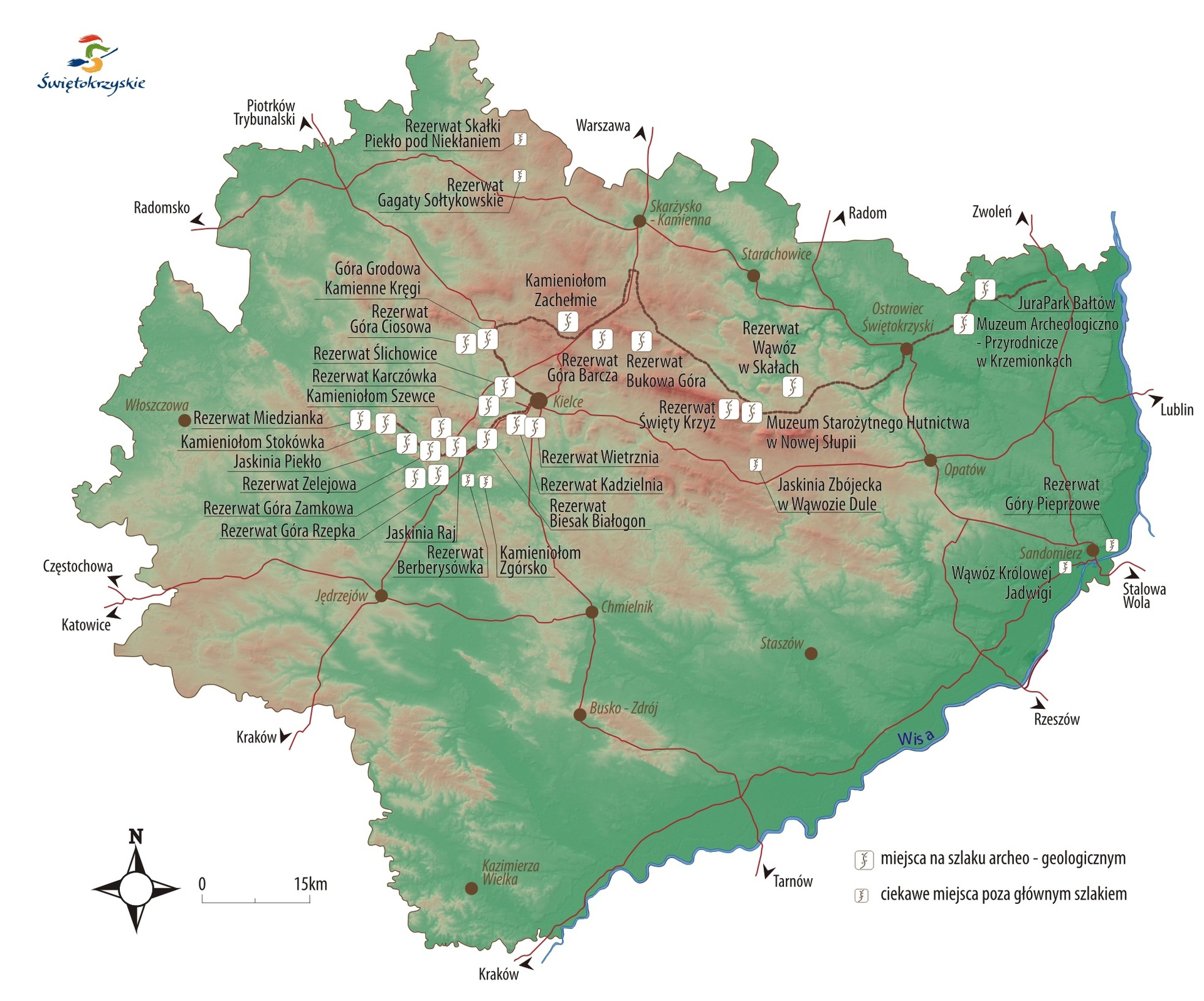
Świętokrzyski Archeological - Geological Trial - additional objects


Practical Information
- Detailed InformationZwińRozwiń
- Object type:
- Automobile
- Difficulty of the route:
- Beginners
- Route route:
- Kielce
- Kielecki
- Konskie
- Ostrowiec
- Route length:
- 500km
- Tourist region:
- Kielce Region
- Końskie Region
- Ostrowiec Świętokrzyski Region
- Organizer name:
- Świetokrzyskie Regional Tourism Organisation
- Organizer data:
- 25-033 Kielce, ul. Ściegiennego 2 32
- Phone:
- +48 41 348 00 60
- fax:
- +48 41 348 00 60
- E-mail:
- informacja@swietokrzyskie.travel
Description
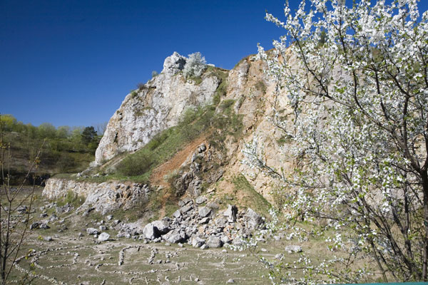
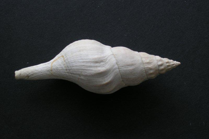
Bałtów
A charming town located in the gorge of the Kamienna river, which meanders calmly by steep rocks of white Jurassic limestone. There rocks formed in a sea about 160 million years ago. Calcareous rock walls are intertwined by valleys, which in the higher parts cross over to ravines and gullies, often cut in the loess, which was formed during the last several thousand years. An interesting fact about Bałtów are traces of dinosaurs found here, imprinted in the calcareous rock. As research has shown, traces could only have been created only when the sea had withdrew. The history of the traces began with a legend about the "Devil"s Foot" told for years, which the devil has left when trying to leap the Kamienna river. In these stories, transmitted by local people, became interested palentologists - scientists studying the traces of old age. And so began the fame of this place. In the Kamienna valley there has been created JuraPark where animal models were gathered, which inhabited earth throughout history. Made with great solicitude, replicas show great diversity and development of the animal world with regard to the exceptional group of dinosaurs.
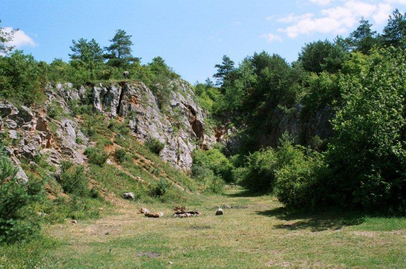
Wąwóz w Skałach
This interesting spot, protected as a geological reserve with an area of 3.18 ha is a deep ravine of the Czajęcicka Plane, flowing into the river Dobruchna, between the villages Skały and Grzegorzowice. In the northern slope of the ravine, extending over a distance of nearly 300 m there are outcrops of limestone and dolomite, with fossils (including Stromatoporoidea, Anthozoa, Brachiopods, remains of Crinoidea) indicating Middle Devonian age and shallow-marine origin of these rocks. The slopes of the ravine are overgrown with scrubs and grassland sites with protected species of plants, which together with rock outcrops, are the subject of legal protection. One should know that this place, together with the rocky outcrops stretching along the river valley Dobruchna, is one of the most important Devonian site in Poland, studied by geologists for over one hundred years, as the Grzegorzowice-Skały profile. In the rocks, in their natural or artificial exposures there have been found thousands of fossils, including many species extremely valuable for the study. When looking closely on the rocks exposed in the ravine, one can probably spot a fossil, which is a relic from the shallow tropical sea from 380 million years ago. Bearing in mind that in the reserve acquiring rocks or plants is forbidden, limit ourselves only to observing and photographing the sights of nature. “Wąwóz w Skałach”(Stone Canyon) ravine in one of the most charming places in the Świętokrzyskie Mountains. The top of the ravine commands a magnificent view on the Holy Cross with the shining monastery on the top. Note: The reserve is located in the vicinity of the active quarry of Devonian dolomites, so while in the area take special care.
The Mieczysław Radwan Museum of Ancient Mettalurgy in Nowa Słupia
New Słupia - one of the most beautiful tourist resorts in the Świętokrzyskie Mountains located at the foot of Łysa Góra, has a very interesting history related to the former iron metallurgy. The north-eastern part of the Świętokrzyskie Mountains, in the past was the largest in Europe, outside the Roman Empire, iron ore mining and metallurgy district, which operated for several hundred years - since the 2nd century BC to the early Middle Ages. In the area between the eastern part of Łysogóry and the Jeleniowskie range and the Kamienna valley, there have been found traces of iron in the form of slag block clusters, which are the remains of old bloomeries (called dymarki). In New Słupia, on the in 1957 discovered archaeological site, there were unveiled remains 45 furnaces, over which a protective pavilion was erected, expanded later to the Mieczysław Radwan Museum of Ancient Metallurgy. In this unique facility, located at Świętokrzyska 56 street, one can see not only the remnants of bloomeries, but also become familiar with the technique of iron smelting and history of settlement in this area. This extraordinary industrial and cultural heritage has become an inspiration to organize, every year in August, an event “Świętokrzyskie Dymarki”, during which one can watch an experimental smelting of iron, based on the old methods. For lovers of long walks and hikes there is prepared a network of marked hiking trails leading from New Słupia to the most interesting natural and cultural sites in this part of the Świętokrzyskie Mountains.
Święty Krzyż (Holly Cross)
A place - a symbol of the Świętokrzyskie Mountains, has many meanings, which put them in a row of the most important natural and cultural sites in the region. This area, which forms the eastern part of the main massif Łysogóry, made of Cambrian hard, quartzitic sandstone, is topped by Łysiec also known as Łysa Góra (595 m.s.l.) - second-highest peak in the Świętokrzyskie Mountains. The site around the peak is separated as an area of strict protection "Święty Krzyż" with an area of approximately 500 hectares, located within the Świętokrzyski National Park. Here are protected the most valuable forest communities of a primeval forest, with fir and fir-beech forest. A peculiarity of inanimate nature are great forestless rock rubbles, which for centuries were for local people places "naked from the forest", which contributed to the consolidation of the name “gołoborze”. The emergence of these forms is associated with Pleistocene glaciations in the era when the highest peaks protruded above the ice-sheet and exposed rocks were destroyed by the intense frost processes. Święty Krzyż is also the place of cultural and religious dimension. In ancient times and early medieval pagan deities were worshiped here, which remained in the form of a cult bank, whose fragments are preserved in the southern, eastern and northern parts of Łysiec. About 400 m east of the summit there rises, built in the early 12th century, a church and convent of Benedictine and early baroque pearl - the 17th century Oleśnicki Chapel. The relics of the Holy Cross are kept, currently in the Sanctuary of the Relics of Holy Cross. It is the place the heart of the region beats, from which this place drew its unusual name. While at Święty Krzyż visit is the Museum of Nature of the Świętokrzyski National Park.
Bukowa Góra
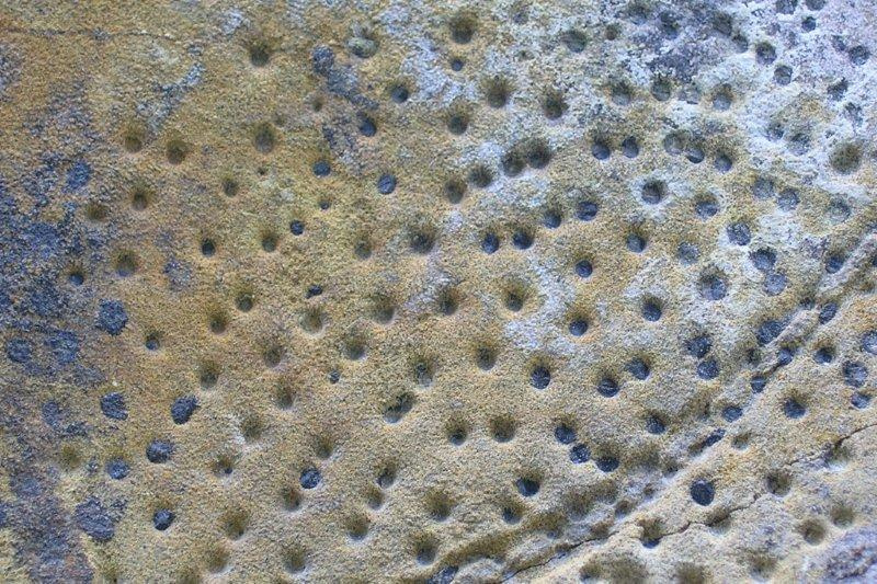
Bukowa Góra is the 8.5 km long ridge made of early-Devonian quartzite sandstone, building in top parts interesting rock formations. The culmination of Bukowa Góra (482 m.s.l.) constitutes the central part and the highest elevation of the Klonowskie range. This area is covered with fir forest, with a rich and varied undergrowth, which also includes protected species of plants. In the dorsal parts of Bukowa Góra, an area of approximately 90 m2 there are numerous blocks and rock monoliths of up to 5 meters high. This is an interesting example of outliers, which formed during the glaciations, as a result of processes similar to those that take place today at the polar regions. Looking at the rock blocks one can see interesting relief dissected by erosion and weathering processes. Rock carving is diversified by vertical clefts and larger rock cracks. Rocks, which are in a lesser or greater degree expose along the ridge, formed originally as a gritty sediment of a shallow marine tank. In some varieties of sandstone building the Klonowskie range imprinted traces of brachiopod shells can be seen. Where the rock is composed almost exclusively of the remains of brachiopods then this is so-called “spirifer sandstone”. A group of rocks of early-Devonian sandstone is located at the top, northwest of the main peak of the Klonowskie range, by the green hiking trail leading from Łączna to Psary and Bodzentyn.
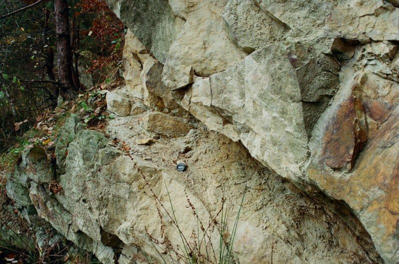
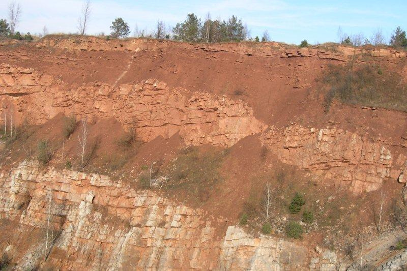
Zachełmie
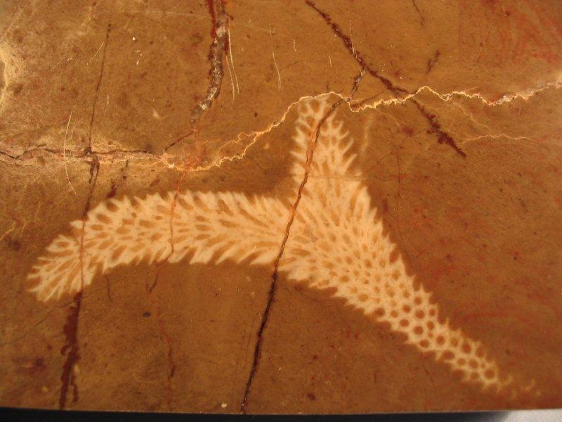
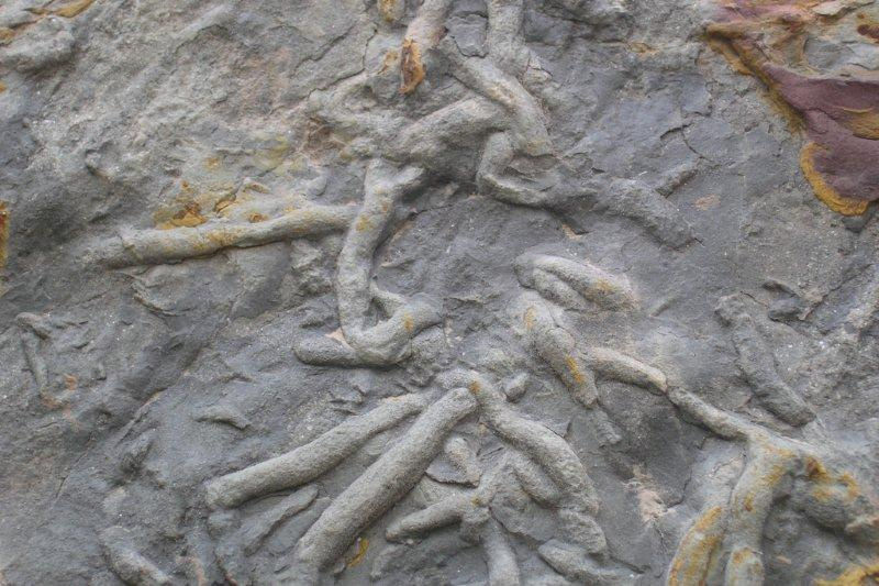
Zachełmie quarry occupies the western part of Chełm mountain. For many years it was the site of mid-Devonian dolomites extraction. The material from mining was used in metallurgy, glass industry, roads and railways. Iron oxide – hematite was also extracted here. Mining was completed in 1978. Maintenance works have revealed interesting geological profile. It is the rock pillar 20 m high and about 50 meters wide where one can see a contact of the mid-Devonian dolomite from 395 million years before with the conglomerate and sandstone of the Permian - Triassic, from 255-251 million years before. Preserved in the outcrop, dolomites were in the past folded and steeply sloped as a result of orogenic movements. On the dolomite, nearly horizontally there occur reddish river deposits, lake and shallow-marine formed in the Permian-Triassic period. Structures on the south wall of the pit, formed by the ascent and drying of the seabed, which are fossilized slit cracks, are among the best preserved of such deposits in the world. Sensational discovery that took place in this quarry, has given weight of world rank. Tetrapod’s tracks found here, the first vertebrate that emerged from the sea, became the basis for changes in the dating of the output of these animals on land of about 18 million years before. Tetrapods were a link between fish and four-footed animals. Precise calculation of tracks’age in the sediment, was based on conodonts - jaws of primitive Chorea, which are considered the index fossils. Index fossils are extinct organisms which lived in large quantities on a large space and for a very short period of time.
Góra Grodowa
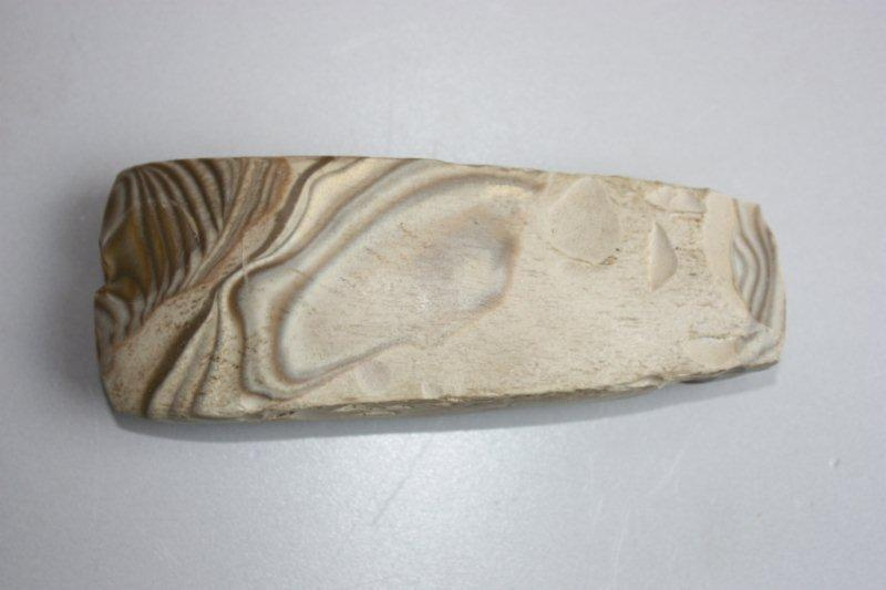
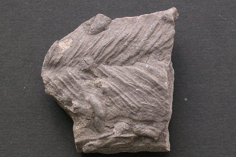
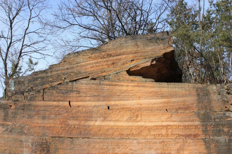
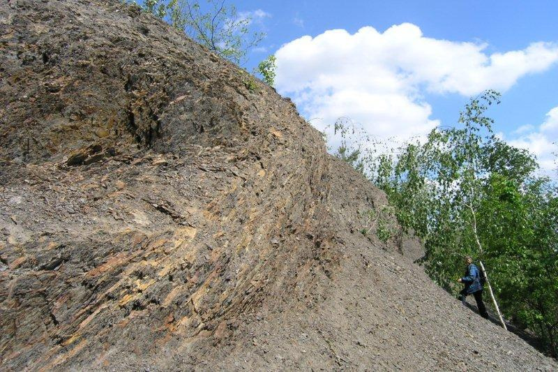
Góra Grodowa (395 m. s. l.) near Łysa Góra and Dobrzeszowskie mountains, was the place of worship in the pagan period. Around the 10th century there was an early medieval settlement whose traces were found during archaeological research conducted in this region in the years 1958 - 1960. The only remains are the poorly preserved stone and earth embankments around the area of about 1500 square meters. A shrine, built at the top part of the hill, is located on the former site, which, according to a legend was built on the 100th anniversary of Swedish troops repulse from Tumlin areas. The northern part of hill is occupied by the old workings and still open sandstone quarry. Deposits present here formed during the Lower Triassic (250 million years ago). They are mainly of eolian origin that is formed of quartz grains, blown by the wind. Exploitation works carried out here have revealed a very interesting diagonal layering. At the time of deposit forming, there were periods when the area was periodically covered with water reservoirs and rivers. Traces of these events are preserved in rocks, traces of water waves reflected at the bottom of the tank in the form of wrinkles current, so-called ripple marks. One can meet traces of drying of small water reservoirs, as evidenced by fossilized rolls of mud. Phenomena occurring in the outcrop are textbook examples of sedimentation, that is formation of deposits characteristic of fossil dunes of the Triassic period. The sandstone mined in the pit was used for centuries as building material in the construction of sacred buildings, stairs, portals, flagstones, statues, and as a material for lining blast furnaces and glass.
Ciosowa
Ciosowa (365 m. s. l.) belongs to the Tumlińskie Hills and is their last link to the south with a clearly distinguishing, in the terrain morphology, slope, falling steeply to the river Bobrza. The mountain is one of the many hills in this area composed of early Triassic sandstone. The northern wall of the closed quarry, approximately 20 meters high and 70 meters wide, was placed under legal protection. Cherry reddish sandstone coloration is caused by an admixture of quartz-hematite iron mineral. The rock is a sediment of eolian origin formed by quartz grains blown by the wind. It formed in hot, dry, semi-arid climate. Small loam stratifications indicate the occurrence of periodic water reservoirs and rivers in the area. The proof of their existence are wrinkles, that is reflected in the bottom of the tank waving signs, called ripple marks.Rock material mined in the outcrop, was perfectly suitable for performing the millstones, curbs, paving and cladding and many architectural details, which can be found today in historic and contemporary buildings. In the quarry there were made fittings used to line interiors of blast furnaces in the Old Polish Industrial District. The area of Ciosowa during the January uprising was a place of fights. On 10 June 1863 the insurgents troop under the leadership of Dionizy Czachowski fought here with Russian soldiers. When the quarry was closed, the nature dunned for its place, causing a fairly rapid encroachment, trying to heal the wound, which a man put to the original landscape.
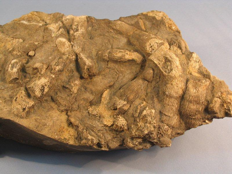
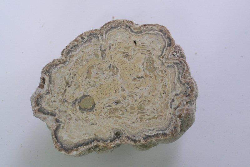
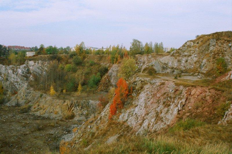
Wietrznia
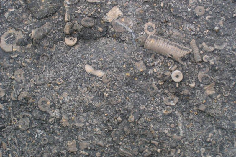
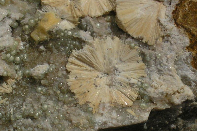
Wietrznia (312 m. s. l.) is the last in the east located hill in the Kadzielniańskie range. Formed in 1999, a Zbigniew Rubinowski reserve covers an area of 17.95 hectares. Excavation of calcium - dolomitic rocks lasted from 1893 to 1974. Reserve with a total length of 800 meters was created from a combination of workings Wietrznia, Międzygórze and Międzygórze East. It is one of the largest outcrops of Devonian rocks in Poland. One can trace the entire history of life in the sea between the end of middle Devonian to the end of the upper Devonian, the period from 386 to 365 million years ago. Exposed sediments formed at the bottom of warm sea, where fragments of broken coral reefs gathered. Mineralization in the reserve, numerous fossils, tectonic phenomena and karst features are sufficient evidence to include this outcrop to the objects of exceptional educational virtues. Among the minerals found here are calcite, galena, barite, pyrite, copper minerals - malachite and azurite. Fossils represent Anthozoa, Brachiopoda, Stromatoporoidea, Gastropoda, Ostracoda and the main attraction of this place -Placodermi (armoured fish). Numerous faults are the indication of tectonic movements. Karst phenomena observed throughout the working, are the basis to recognize this place as uniquely worth protection. Located nearby is the Geoeducation Center, which is the main component of Archeo-Geological Trail. This, built by the Geopark Kielce object, is not only an exposition of geological collection from the Świętokrzyskie region, but above all a place of broader geological education for the young and tourists.
Kadzielnia
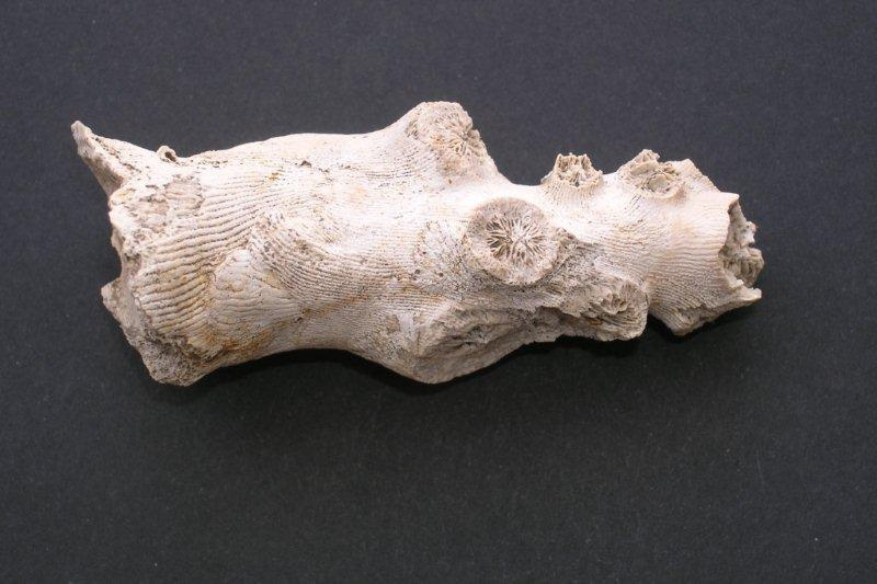
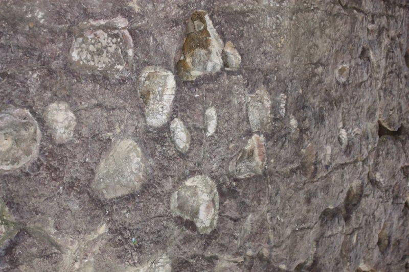
Kadzielnia is the main link of the Kadzielniańskie range, which includes Dalnia, Grabina, Karczówka, Mount Cmentarna, Psie Górki and Wietrznia . A rock monolith, called “Skałka Geologów” was placed under legal protection. In 1962 the reserve was created with an area of 0.6 ha mainly to protect the mining karst phenomena here, which belong to the most beautiful in Poland. Kadzielnia is the largest concentration of caves and rock shelters in the Świętokrzyskie region. There are 26 caves in the whole complex. By combining three caves, located in the eastern wall of the excavation, there has been created an underground tourist route approximately 170 meters long. Lasting for about 200 years the exploitation works revealed the profile of the upper Devonian rocks - Frasnian and Famennian. Lower parts, formed during the Frasnian period and represented by rocky limestone, are covered by thin narrow-banked Famennian limestones.Kadzielnia is also a well-known paleontological site with many specimens of fossilized Devonian sea inhabitants found there. Since the accumulated sediment on the seabed created in close proximity to coral reefs, there can be found remains of colonial Anthozoa, Gastropoda, Brachiopoda, Cephalopoda, and Placodermi. Another interesting fact about Kadzielnia is mineralization in the excavation. Tectonic events in the past, caused cracks in which crystallized as calcite, barite, copper and lead minerals. Currently Kadzielnia is a well developed object of considerable educational values and an important point for everyone interested in a geotourism, still developing and interesting form of rest.
Śluchowice
Śluchowice – Jan Czarnocki inanimate nature reserve is the first of its kind in Poland. It was established in 1952. This smallest reserve in Kielce has the area of Kielce 0.55 ha. It is located in the hill Ślichowica (303 m. s. l.) belonging to the so-called Czarnowskie Górki and it includes a rocky perch from 8 to 10 meters thick preserved between two excavations. In the western pit at its eastern wall there is the most valuable part of the reserve. These are strongly folded layers of rock formed from thin shoal limestone, marl and shale. Here one can see the classic form, presented in most textbooks describing the tectonic phenomena, which is an overthrown fold, located in the upper part of the wall on the north side. The rock in the outcrop formed during the late Devonian, about 360 million years ago.It was created on the seabed near the coral reef therefore in sediments Bivalvia, Brachiopoda, Crinoidea, Trilobites, and few corals can be found. Reserve protection also include interesting vegetation overgrowing the area of both workings. One can find barberry, cherry steppe, wild rose bushes and other plants rated among dry grasslands. The top of the hill offers panoramic views over a large area of Kielce and the Świętokrzyskie Mountains. During good weather one can see in the east the whole range of Łysogórskie range with Łysiec and Łysica, the north the Tumlińskie Hills and westward the Oblęgorskie range. Southward to Śluchowica, among the trees one can see an albescent monastery on the Karczówka hill, together with the adjacent hills of Dalnia and Grabina. At the southeast there is Telegraf, the highest from the surrounding hills in Kielce.
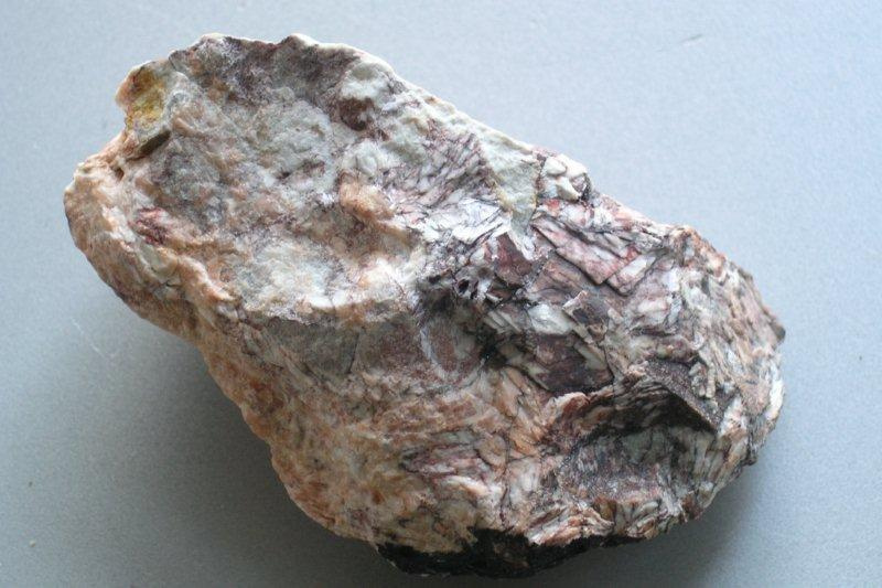
Karczówka
Karczówka (340 m. s. l.) is a landscape reserve, with the area of 26.55 hectares covering the forested hill with a monastery located on the top of it. It is a part of the Chęciny - Kielce Landscape Park, forming its north - eastern enclave. The hill is composed of limestone formed during the middle and upper Devonian. In the past, it was a place of intense excavation, aimed at raising the ore of lead – silver-bearing galena. On the area of Karczówka and the adjacent hills, there were documented evidence of 3320 historical mining sites. The occurrence of mineralization is associated with a lot of tectonic fractures and faults formed in the limestone rock, were metals accumulated. The crack method was used by mining and lasted for nearly 600 years. Recent attempts to reach the underground wealth took place during World War I, when in, the not too distant hill Grabina, a 118-meter deep operating shaft was made. It was the deepest shaft in the Świętokrzyskie Mountains. The trace of mining activity in the area of Karczówka is a statue of Saint Barbara made of one piece of galena. Located in the chapel under the bell, this figure has become a major attraction of the place.
Extraction of such large masses of galena, called “grana” (lumps), evokes Hilary Mala, a mineworker who found them. This took place December 7, 1646 and from these extracted solids, three religious figures were made. Saint Barbara was curved out of the largest solid and from the remaining ones sculptures of the Blessed Virgin Mary, located in Minor Basilica in Kielce and Holy Anthony placed in the church in Borkowice near Przysucha.
Biesak-Białogon
This charming old forest, with an old, partially flooded mining excavation, located on the north-western slope of Kamiena Góra, in the Posłowickie range, was placed under legal protection in 1981 as an inanimate nature reserve Biesak-Bialogon. Efforts to protect this special place directed to maintain a unique profile of old Paleozoic rocks. Thanks to mining works run for many years one has an unusual opportunity to look into the “interior” of the Posłowickie range, which so picturesquely surrounds Kielce from the southern side. The walls of the excavation and dike, leading to the north side, there are exposed sandstones, silts and shales of marine origin representing two geologic periods: Cambrian and Ordovician. Sandstones, silts and shales from the early Cambrian occur in the northern part of the excavation. These are some of the oldest rocks in the Świętokrzyskie Mountains dating about 540 million years. The younger, Ordovician rocks formed in majority as quartz sandstones are to be seen in the north-eastern part of the quarry. A profile of rocks in the reserve hides a few more secrets. The most interesting of them includes the position of the Cambrian and Ordovician rocks against each other. In a normal, undisturbed position layers of rock lie horizontally, in a way that younger rocks cover older rocks. In case of Biesak-Białogon in some places the situation is completely reversed, i.e. the older rocks of the periods – Cambrianare is situated on to the younger Ordovician sandstones. Inverted arrangement of rock layers is an evidence of the earth’s crust activity associated with orogenic movements, which over millions of years shaped the Świętokrzyskie Mountains.
Jaskinia Raj
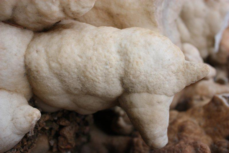
Jaskinia Raj (Cave Paradise) fully deserves to be called the biggest tourist attraction of the Świętokrzyskie region. The place where the cave was discovered in 1964, is located in the northern slope of the Malik mountain ridge, which belongs to Bolechowicki range. In 1968 the reserve “Jaskinia Raj” was established, of an area of 7.76 hectares. Elevation at which it is located, is built of thick-banked limestone formed in the middle Devonian. The cave is the result of karst phenomena. Karst phenomena involving dissolution of carbonate rocks by the water had in the initial phase a destructive action. Karst crevices, chimneys, voids and caves were formed then. In the next step the precipitation of calcium carbonate from water took place in the form of speleothem. And so formed stalactites, stalagmites, draperies, stalactites, columns, bowls, flowstones and cave pearls. The accumulation of stalactites, which comes to 200 per 1 square meter, is second to none in Poland. The total length of the corridors is 240 meters from which 180 meters were made available to tourists. Research conducted in the cave prior to its opening showed that the place had been inhabited twice about 50 thousand years ago. A number of Palaeolithic flint tools, animal bones and antlers were found in the silt. To maintain the proper temperature and humidity, tour takes place in well-defined groups. The cave is also a temporary habitat for about 160 bats including a brown bat and a big bat. Jaskinia Raj because of its beautiful, unique speleothem formations fully deserves its name.
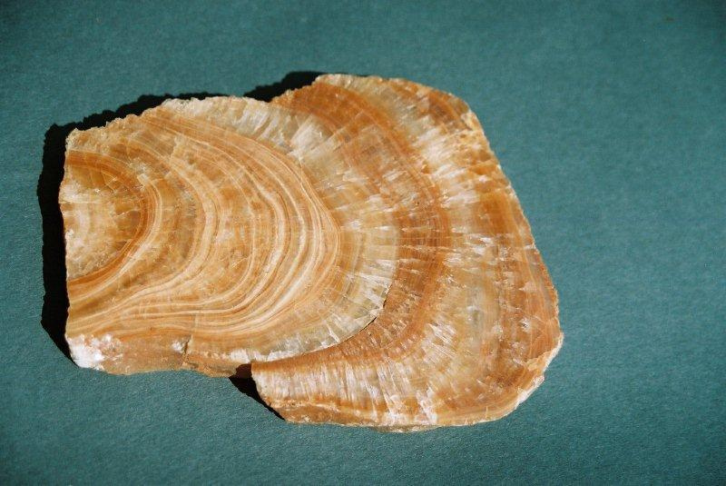
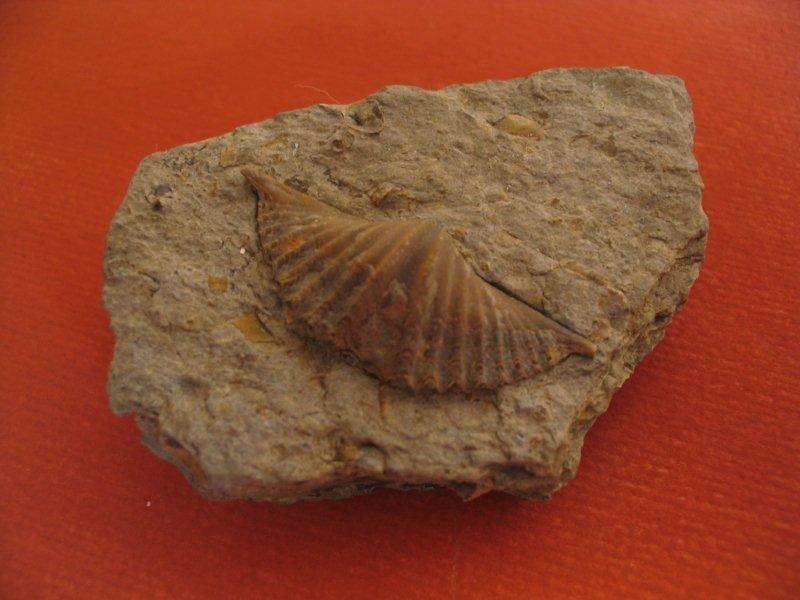
Szewce Quarry
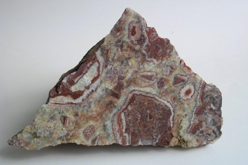
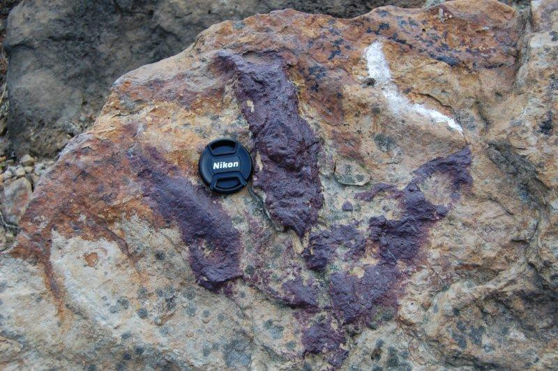
An interesting object, associated with the historic mining of the so called Chęciny marbles, is situated on the eastern slope of the Okrąglica mountain. In the former, now somewhat overgrown, quarry there was mined a unique Devonian limestone, characterized by a very interesting, sand-pink tint with rare calcite veins and the remains of fossils - including Amphipora. The presence of these fossils indicates a middle Devonian age of rocks and its marine origin. One should know that the term Chęciny “marble” refers to, occurring in great numbers in this region, blocky varieties of carbonate rocks, which, when polished obtain very good gloss and attractive color. These features caused that since the 16th century the rocks from the outcrop were often used in masonry to manufacture architectural details. Some varieties were used to produce small ornamental objects. „Marble” from Szewce was used mainly as a material for cladding and flooring. Szewce, as well as other known in the area of Chęciny-Kielce – old quarries, are a valuable witness to the history of rock mining, which not only documents the type of minerals, which were obtained before the ages, but also provides knowledge about the size and techniques of mining. Size of excavation (about 80 m in diameter and 20 m deep) indicates a fairly large size of rocks excavation. Land adjacent to the quarry Szewce is also an area of historical mining of lead and copper ores. Okrąglica mountain and its surrounding was mentioned in the royal review as one of the eleven so-called "ore hills" located in the vicinity of Chęciny, where the mining took place between the 14th and the beginning of the 20th century.
ZelejowaMountain
Zelejowa mountain is one of the most interesting geological sites in Poland. The inanimate nature reserve covers central part of the limestone ridge, cut by mining excavation. Limestone ridge and slopes of Zelejowa are a classic example of karst surface. Wandering along the red trail, which leads through the Zelejowa mountain, one can often observe beautiful examples in the form of grooves and fissures of numerous karst cutting into in the massive limestones of the upper Devonian. In the old workings, disconnecting a massif, there are also examples of Permian-Triassic and Cenozoic fossil karst - karst crevices and craters filled with a reddish coloured sediments. The main part of the reserve, a quarry "Szczerba" dividing the ridge of Zelejowa, which is the most famous historical place of excavation of the beautiful " Chęciny marble " - so called "różanka zelejowska". The name of this variety, with a very decorative pattern, comes from the pinkish color of calcite, either cutting gray Devonian limestones, or occuring together with their crumbs, as mixed material forming the so-called calcite-calcareous breccia. Różanka zelejowska, for a long time was a very appreciated variety of "Chęciny marble". It was used in architecture as a material not only for making decorative cladding but also architectural details and decorative trinkets. Currently, in the walls of the old workings the evidence of old mining techniques can be seen in the form of loosening of rock blocks signs. Animated nature, is represented by the valuable species of rockplants and xerothermic grasses.
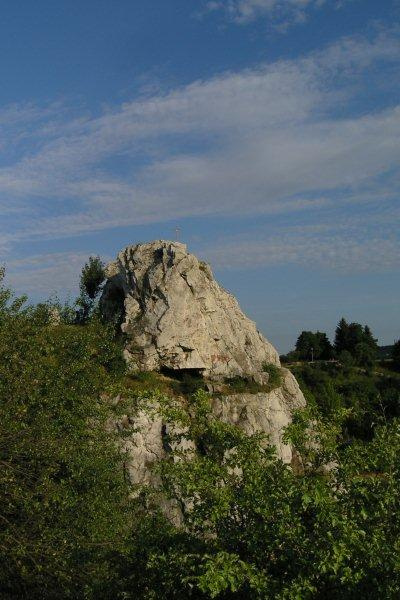
Zamkowa
This is the biggest tourist attraction of the Chęciny-Kielce Landscape Park. Rising above the surrounding ground, a limestone hill with a height of 356 m above sea level, was named after the majestic ruins of the defensive castle from the late 13th century. The defensive features emphasize rock outcrops,
which are the natural bed, where the buildings’ walls were placed. The rocks on the ridge, as well as in two old quarries cutting in the mountain: the western and eastern, are variations of the late Devonian limestone. These rocks, well exposed in the western quarry, steeply incline to the south. However, if one goes to the northern side of the mountain one will see, older from them, the middle Devonian dolomites. This difference in geological structure and the presence of a fault, which runs at the southern foot of the mountain, determines its unique asymmetrical shape - southern slope is more inclined than the northern one. It is worth paying attention to this fact when watching Góra Zamkowa from the nearby Góra Rzepka. Another attraction for nature peculiarity seekers delivers the old quarry on the western slope, located just off the road leading to the castle from this side. In the limestones exposed in the quarry one can find numerous remains of organisms preserved as fossils. A careful observer will notice the shells of Brachiopoda, typical filamentous Amphiporas, segments (Trachytes) of Crinoidea and Anthozoa. These are fossil evidence that the exposed limestone rocks here had formed from sediment accumulated over 360 million years ago in a shallow, warm sea - like modern coral reefs. An addition to the geological and historical attractions of Góra Zamkowa are traces of former ore mining, related to the extraction of silver-bearing galena.
Rzepka Mountain
Located less than 800 meters to the west of Góra Zamkowa - Góra Rzepka reserve, holds many secrets, which are worth discovering during the visit in this remarkable place. Reserve created in 1981 includes two hills Rzepka and Beylina made of limestone and dolomite in the late Devonian. Southern slope of Rzepka is cut by an amphitheatrically located, former quarry where middle Devonian dolomites were mined. The workings revealed interesting geological profile, which extends over several hundred meters. Dolomites are riddled with a dense network of cracks and faults. Some old cracks were filled with calcite mineralization. A particularly beautiful example can be found in the western part of the excavation, which revealed a thick vein of white calcite-różanka, with a karst channel adjoining to it. The cracks contain mineralisation with galena, which occurs together with calcite and barite. Historical mining traces of galena from the 16th and 17th century appear in many places, in the slopes of the massif. Rzepka is also an important fossil karst site (i.e. filled with sediment). There are interesting examples of karst funnels and chimneys fillings in the form of sandstones, indicating the Permian origin of the forms. In the quarry there are also karst cracks formed in the Neogene full of sand from the destruction of massive dolomite. Animated nature in Rzepka is represented, among others by xerothermic vegetation with interesting, protected species, such as Carlina acaulis (dwarf thistle). An additional attraction of this place are educational boards, tourist shelters and open exposure of rocks characteristic to the Chęciny-Kielce area.
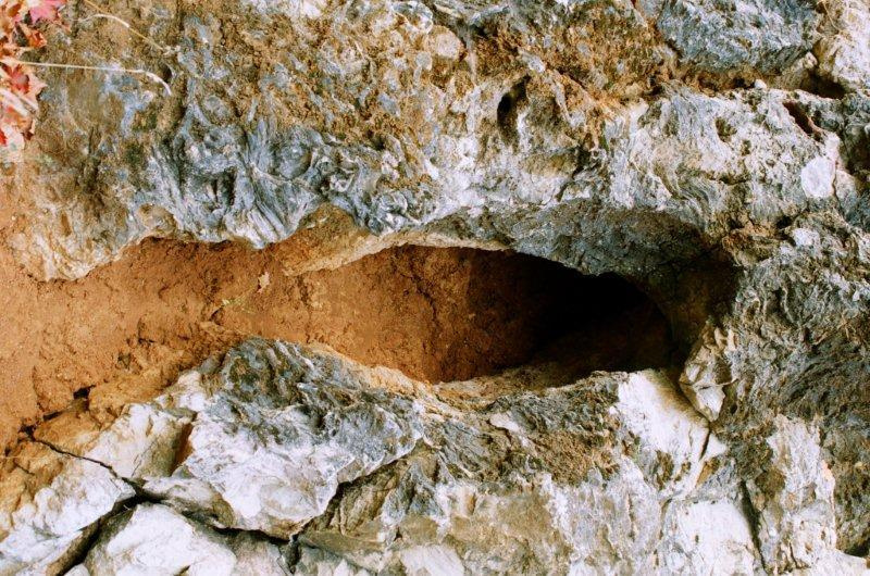
Piekło Cave
Piekło cave under Skiby located on the northwestern slope of Góra Żakowa is protected with a rock cliff composed of massive Devonian limestone, as a monument of inanimate nature. The original name of the cave, is probably a reminder of the folk belief that in all such places looked out for hell pit. Hence in regional terminology there are many places, which in the name have the words hell or devil. Cave, however, despite the name, has more to do with water than with the fire of hell, because it is the result of limestone dissolution by water. A 57-meter long cave, was most likely the result of karst processes in the crevices and cracks in the Devonian limestones. During hundreds of thousands and perhaps millions of years, these processes led to the creation of underground cavities and passages, which were naturally buried by sediments. Today"s state of the cave is a result of both natural processes and human activities that led to the purification of sewage tunnels and some voids. An interesting traces of human activity can be found in the bottom of the main corridor and in the immediate vicinity of the cave. These are the remnants of mining shafts carved in order to search for lead ore (galena). For some time, the cave was partly made available to tourists, through the blue trail and geological path. Today the cave is made available, and in its neighborhood there is a small tourist infrastructure. Currently, the shaft is exposed to a depth of 8 meters, lighted and secured by the appropriate grating and bridge.
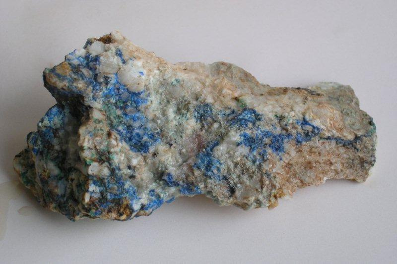
Miedzianka Mountain
This inanimate nature reserve created in 1958, is one of the most important ore mining site in Poland. What former mineworkers mined here indicates the name of a hill. Lasting with interruptions from the 14th to the 20th century, the exploitation of copper ore, left behind several kilometers of underground walkways of old mines. Moreover, there are numerous tracks on the surface, in the form of funnels, which are remnants of inlets into mine shafts or piles, which were covered up by gangue. At some landfills there are fragments of limestone, containing intrusions and incrustations of typical copper minerals: green malachite and blue and navy blue azurite. Inlets open to old wells are still clearly visible on the slopes of the massif - hence during the hike along marked routes in the reserve special care must be taken very carefully and walking on not designated paths and trails is forbidden. A unique trace of the mining at Miedzianka is, the only, preserved today in the Świętokrzyskie Mountains, tower shaft of the last mine. It is located at the former school building, on the east side of the reserve. The mountain stands out in the surrounding landscape, as a beautiful limestone rocky ridge with three peaks. The highest of them forming the summit of the massif reaches a height of 356 m. s. l. An educational, mining-geological path runs through the reserve and leads, among others to the top of the hill, where one can enjoy the magnificent panorama. At the foot of the reserve, there is the Museum"s Board of Ore Mining, where one can see, among others mineworker’s old tools, a collection of minerals, and a medieval miner at work.
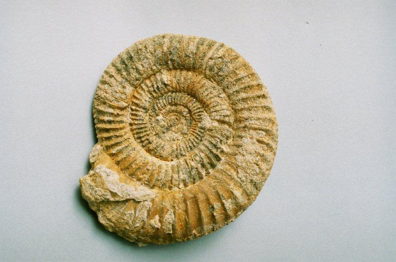
Krzemionki
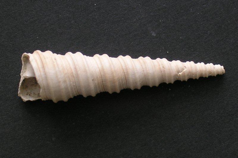
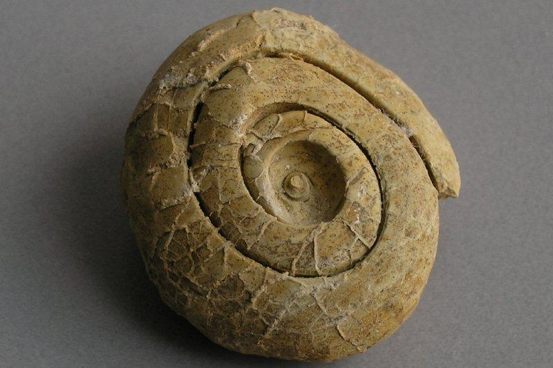
Neolithic flint mines were discovered in 1922 by a geologist, Jan Samsonowicz. Limestone rocks, in which there are flints, were formed during the late Jurassic - 150 million years ago. This took place at the same time as the dinosaurs on land experienced their greatest growth. The deposit of the striped flint in Krzemionki was mined in the period from 3900 to 1600 BC. While visiting the mines, one can see a considerable craftsmanship and extensive miners’ knowledge at that time. From flint axes and chisels and arrowheads were made. With time, in addition to typical utility function, flint has been used for different purposes. Ceremonial ax blades were manufactured, which were put into the warriors’ graves. At present, flint has become the object of interest in the form of jewellery.
Wietrznia
The Zbigniew Rubinowski reserve is a place with the, longest in Poland, late Devonian profile. Rocks building it were formed on the seabed 380 million years ago. In the pit one can see many fossilized remains of organisms such as, Anthozoa, Stromatoporoida, Cephalopoda, Stromatoporoidea and Placodermi. Faultings, tectonic mirrors and the folding of rock layers are proof of tectonic movements in the past. The presence of minerals such as calcite, barite and galena is related to the cracks. As a result of weathering processes, the karst phenomena developed. Craters, boilers karst, caves and rock shelters were formed then. Located nearby is the Geoeducation Center, which is the main component of Archeo-Geological Trail, run by Geopark Kielce.
Kadzielnia
Kadzielnia is the most famous among the Kielce reserves. A rock monolith, in the middle section of the excavation called “Geologist’s Rock” was placed under legal protection. Karst formations, some of the best preserved phenomena in the country, can be seen here. As a result of excavation works a profile of rocks from the late Devonian period were exposed. This profile contains rock limestones with a great number of fossil forms, which are covered by marly limestones. There are here 26 caves. An underground tourist route is a great attraction of this place. A walking path with vantage points, which allows to safely visit this place, goes around the reserve. The modern amphitheatre, which merges with the surrounding rocks in a very interesting way, is the only such scene in Poland.
Ślichowice
Poland"s first geological reserve, established in 1952 at the initiative of renowned geologist Jan Czarnocki. It is an object of high educational values. A rock strip between the two excavations was placed under legal protection. Rocks occurring in the reserve are marine sediment formed in the late Devonian period about 375 million years ago. The most interesting element of the object is a recumbent fold. It was created as a result of folding narrow-banked limestone and shale. Foldings are the result of massive tectonic movements elevating sediment accumulated on the seabed. Śluchowice reserve is a prime example of tectonic movements and is presented in many publications and textbooks. The hill, on which the reserve is located, is also a great vantage point.
Paradise Cave
Jaskinia Raj (Paradise Cave) because of the unique speleothem fully deserves to be called the biggest tourist attraction in the Świętokrzyskie region. Discovered in 1964, this cave is second to none in Poland. It formed in the northern slope of Malik mountain as a result of karst phenomena. Karst is a type of chemical weathering of carbonate rocks - limestones and dolomites. Research conducted in a cave have proven that it was inhabited for the first time, already 50 thousand years ago. Stone tools, bones and antlers found in the slit are another evidence of human stay in this cave.
The unique speleothem formations are represented by stalactites, stalagmites, columns and draperies. An interesting formations are cave pearls.
Piekło Cave
The cave is located at the sharply slopoing western ridge of cut slope of Góra Żakowa. Is also called Piekło pod Skibami or Piekło Głęzickie. It was formed by karst phenomena. Carved by water, it has a length of 57 meters. About 10 meters from the main entrance, on the cave floor, there is a recess which is a remain of an old mining shaft built to search copper and lead minerals. Currently, the shaft is exposed to a depth of 8 meters, lighted and secured by the appropriate grating and bridge. The cave is home to several species of bats and snails, spiders and crickets. In the immediate vicinity of the cave there are traces of exploration and exploitation of ore and rock materials. While in a close area of the cave, one should take special care and should not stray from the designated routes.
Miedzianka Mountain
„Góra Miedzianka”reserve, is the main object within the Chęciny-Kielce Landscape Park. In the past, the mountain was the center of ore mining of the Świętokrzyski region. Traces composed of rock voids, tunnels and shafts formed by the exploitation of ore, have a total length of about 4 km. The hill is formed out of limestone dating back to the middle-late Devonian period. Numerous cracks of rocks were filled with calcite veins, from which minerals such as malachite, azurite, chrysocolla, chalcopyrite, barite and galena crystals were sourced. In recent years the Miedzianka heyday, colourful limestone was mined. In the immediate vicinity of the reserve, there is, founded in 2008, the Museum Board of Ore Mining with a collection of old minig tools and extracted minerals.
Rzepka
Located about 800 meters west of Góra Zamkowa a reserve "Góra Rzepka," is the result of works carried out in a quarry "Korzecko". South-facing slopes of two hills, Beylina nad Rzepka, built of limestone and dolomite, were exposed. These rocks deposited in a marine environment during the middle Devonian. A rock wall formed at the end of mining works, is an interesting educational site. Numerous calcite veins and faults riddling sediments visible in the outcrop are the proof of tectonic phenomena that took place here in the past. With these phenomena, there is also connected mineralization in the existing pit. Both hills were a place of exploration and exploitation of ore as evidenced by numerous preserved traces of ancient mining.
Zamkowa Mountain
Góra Zamkowa and the majestic ruins of the defensive castle, is the most characteristic tourist attraction of the Chęciny-Kielce Landscape Park. The castle dating from the late 13th century, was placed on top of a limestone hill. The sediment from which Góra Zamkowa is formed, had accumulated on the bottom of the shelf of a warm, shallow sea in the middle and late Devonian. Numerous, preserved in the rock the remains of the inhabitants of warm seas are the evidence for its origin of.
One can find fossilized Brachiopoda, Crinoidea, Anthozoa and filamentous Amphiporas. Among the limestones there are thin layers of siliceous rocks - the cornea. Preserved traces of ore mining connected to the excavation of galena are an attraction of this place. Góra Zamkowa was a place of limestone extraction.
Bałtów
This charmingly situated on the banks of the Kamienna place, is the leading object of the Polish Jurassic Parks. In Jurassic Park, established among picturesque rocks, in the river valley there have been collected models of the world of organisms that lived on earth throughout history. Made with high precision models of dinosaurs illustrate the diversity and the development of this group of animals in successive geological periods. Park in Bałtów is a place of high educational values. The object is placed under the patronage of the Polish Geological Institute in Warsaw. Enriched with more and more new tourist destinations, it provides attractions to each age group. Apart from typical geological attractions, here one can ride horses, swim raft, meet wild animals in Zwierzyniec Bałtowski (Zoo) or roam the mysterious gorges and ravines.
Zachełmie
A reserve created in a former dolomite quarry in Zachełmie is an unique object in the Archaeo-Geological Trail. For years it was known only from the monument of inanimate nature. The protection was placed under the place where a contact of Devonian and Permian-Triassic rocks with very well preserved angular mismatch can be seen. An interesting fact are, located on the southern wall of the excavation, rock structures, formed during the drying periodically surfacing, seabed. They belong to one of the best preserved deposits in the world. The biggest sensation of Zachełmie are the tetrapod’s tracks, the first vertebrate, who first left the aquatic environment. It provided a link between fish and four-footed animals. It is the only occurrence of tetrapod’s tracks in the world.
Gołoborze "Boulder Hills"
Gołoborze located on the slopes of Łysa Góra, is the most recognizable landmark of the Świetokrzyskie Mountains. It is a characteristic feature of the entire region. Rock rubble made of hard, middle Cambrian sandstone, formed during the glaciations. Harsh climatic conditions caused the destruction of rock outcrop protruding above the glacier. Fragmented blocks of rock rolled down the slope to form sediment. This happened during the last 1 million years. Currently, the prevailing climatic conditions favour slow overgrowing of gołoborze. Another interesting landmark of Łysa Góra are the circles surrounding the sites of pagan worship dating back to 8th–10th century. A worth visiting is a one-thousand-year-old monastery and Natural Museum of the Świętokrzyski National Park.